Height: 2500 feet
Bible Position: The Central Ridge
Conditions: Cold and Wet, snow on the top
Viewranger Stats:

The exact route we took thanks to Viewranger
Position:
Other Wainwrights on this walk: Eagle Crag
So we only have the dirty dozen left to do, 12 more tops to complete the challenge of 71 tops over 2000 feet. Peter picked me up at 6.30 am and we had already decided to do one of the two High Raise mountains left to do. This one is the smaller of the two in the Central Ridge, very close to Ullscarf which we had done back in June this year.
We arrived in the village of Stonethwaite just after 8.30, got the boots on as well as the warm layers and started walking about 8.45am, tucking into scotch eggs from Angus the butcher as we walked.
Start of the walk
We crossed over Stonethwaite Beck and turned right and began walking along a clear path following the stream slowly up hill.

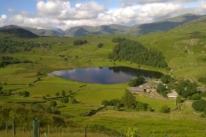
Looking back to Stonethwaite
First Wainwright of the day
As the main stream turned right we continued straight ahead following the path up Greenup Gill towards Eagle Crag and on to Lining Crag. We passed through two or three gates and crossed streams a number of times. As we got through one gate, we saw lots of sheep up on the hillside waiting for their breakfast.

Sheep covering the hillside
A little further up the Gill was this waterfall with what would be a very inviting plunge pool in the summer but not today as it was very wet and cold. It was around this point the snow started to fall as the temperature dropped. We both thought this would be a very nice walk in the summer with plenty to see and some good bait stops.

Waterfall on Greenup Gill
We were heading towards Lining Crag although as were climbed we could not see the full scale of the crag in the poor weather conditions (see below for a photo on the way back down). This was probably the hardest part of the walk, negotiating the path around to the left of the crag, scrambling over wet rocks. Again as we got to the top of the crag we commented what a good bait stop this would be in the summer. Onwards and upwards today however as the snow was falling and we wanted to make sure we could find the path on the way back down. This part of the walk was particularly boggy although partially frozen in places today.
Visibility was very poor as we approached the summit but a handy app I had downloaded kept us on the right track.

Skyline on the Viewranger App showing the nearby mountains by distance
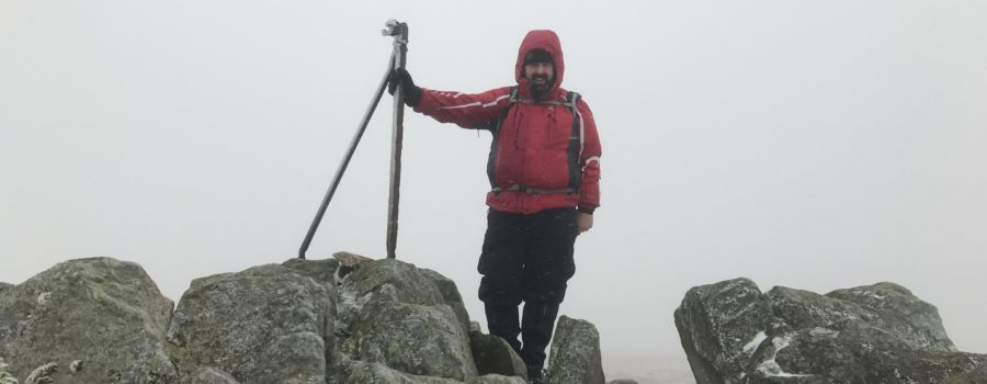
High Raise Summit
We reached the summit at exactly noon, just time for a quick photo, even taking our gloves off for a minute froze our hands so we wanted to get back down as quickly as possible.

A cold, wet and windy summit
The descent
We tried to get back down below the snow line as quickly as possible although with slippery, icy rocks under foot it was a tricky task.

Lining Crag

A closer look at the path around Lining Crag
As we got back down to Lining Crag, the descent was slightly easier because the path was a little clearer. It still took up a little time however, slowing us down as we headed for Greenup Gill.
I had downloaded a new app to my iPhone called Viewranger which was fantastic. You can track your walk as you go. Using Skyline, built into the App you can see what other Mountains are nearby. I forgot to start the app right at the beginning of the walk. Therefore, I missed the first 15 minutes but it is extremely accurate and especially in poor weather very useful.

The exact route we took thanks to Viewranger
We got back to the car about 3.45 so about 3 hours to ascend and just under 4 to descend. Another long walk with Fitbit counting just over 30,000 steps and the accurate Viewranger app recording 6.5 miles. Edging ever closer to the target of 71, this was my 60th top. We are hoping to try to squeeze one more in this year, weather permitting.
See you on the next walk.


Leave a Reply
Your email is safe with us.